
01 / INTERNATIONAL MARKETS ONLY
Non-Invasive UXO
Risk Assessment.
Magnetometric acquisition, AI analysis and automated anomaly discretisation to detect, categorise and georeference potential ferromagnetic threats. No excavation.
This service is available exclusively in international markets, outside Italy.
02 / ACQUISITION
Map the risk.
Without excavation.
Autonomous or assisted acquisition using multisensor platforms and magnetometry: area coverage and georeferenced data, without excavation.
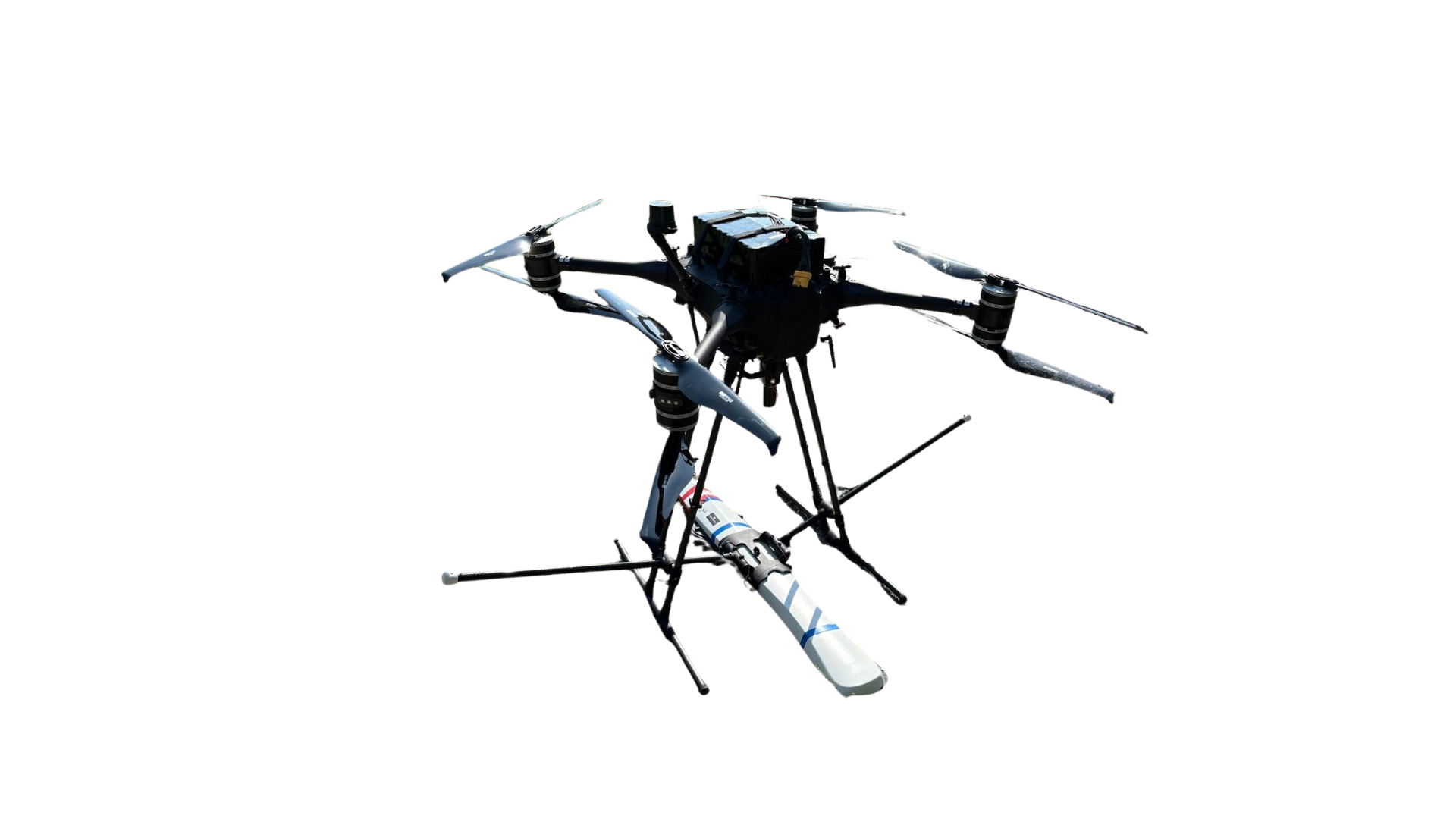 X-HEAVYAIRBORNE MAGNETOMETER
03 / INTERNATIONAL UXO ASSESSMENT
More coverage.
Less exposure.
- UP TO4 ha/h
- High-area-rate aerial acquisition.
- POTENTIAL COVERAGE≈ 320,000 m²/day
- In the reference operating model with 8 acquisition hours.
- REMOTE ACQUISITIONZERO-CONTACT
- No personnel entering the ground being surveyed.
- AUTOMATED DISCRETISATIONAI ANALYSIS
- From survey data to georeferenced targets.
Potential values for the reference operating model; actual coverage depends on mission conditions.
04 / AUTOMATED DISCRETISATION
From anomalies.
To individual targets.
Anomalies are separated into individual targets: their position and magnetic signature support operational prioritisation.
TARGET / STRUCTURED EVIDENCE
Illustrative examples, not confirmed identifications.
05 / INTERNATIONAL / INTERPRETATION AND CATEGORISATION
A ferromagnetic anomaly
is not automatically ordnance.
DeepGeo.AI analyses magnetic signatures, distinguishes probable categories and organises targets in a georeferenced map.
Potential threats, coordinates and priorities in one operational picture.
The survey detects ferromagnetic signatures.
Real orthophoto with an illustrative magnetometric layer: the simulated signal is not a site measurement. Categories and priorities are illustrative.
06 / OPERATIONAL VALUE
Focus attention.
On relevant evidence.
Structured data and prioritised targets for operational planning.
- 01 /
Non-invasive acquisition
The survey collects data without excavation.
- 02 /
Less uncertainty
Anomalies become georeferenced evidence.
- 03 /
Operational continuity
Automated analysis turns data into usable evidence.
- 04 /
Better-informed decisions
Teams plan operations using stronger evidence.
07 / GEOREFERENCED OUTPUT
An assessment that is
documented and usable.
The signed technical report documents the methodology, anomalies, georeferencing and conclusions.
- Survey area and mapping
- Anomaly map and target coordinates
- Probable categories and technical conclusions
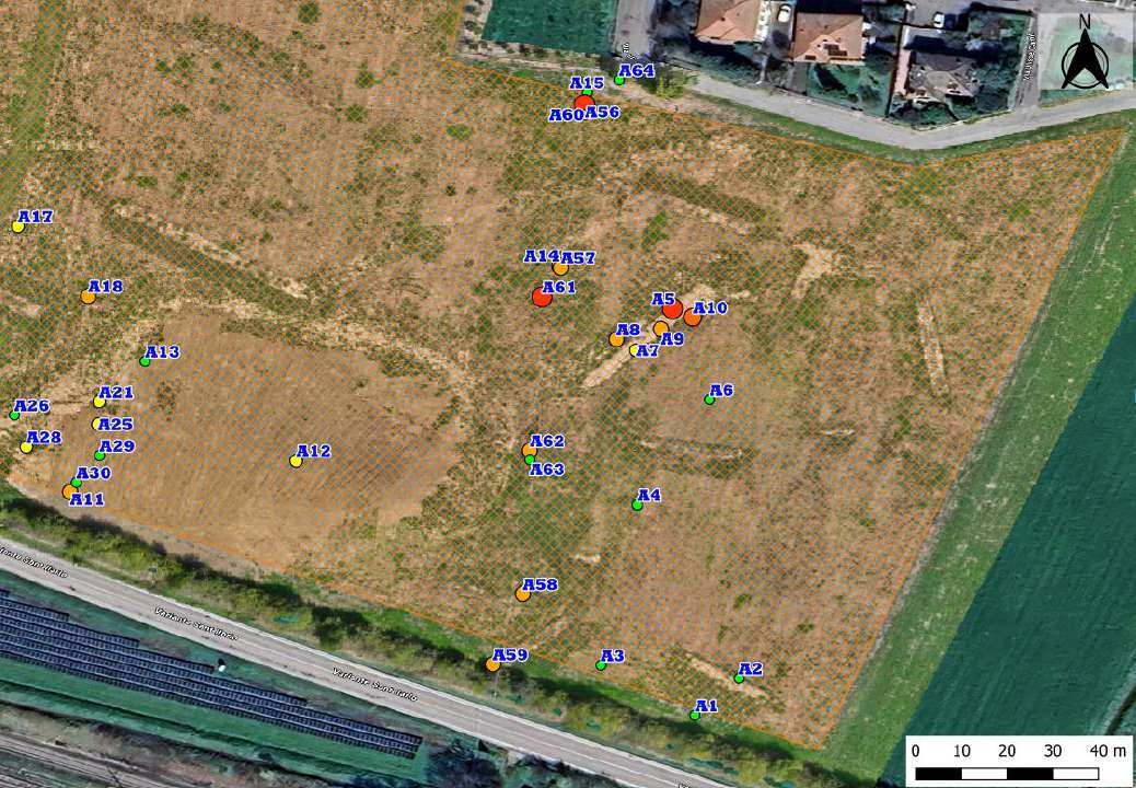
This illustrates the GIS output format, not an international-service case study. Anomalies are not confirmed ordnance.