Request a quote

Underground Utility Mapping & Detection

Turn survey data into network intelligence.

Non-invasive surveys and AI reconstruct the position, depth and geometry of buried utilities, delivering 2D, 3D, CAD and GIS outputs.

Underground Utility Mapping

02 / THE PROBLEM

Know what lies below
before you break ground.

Incomplete maps and undetected utilities increase conflicts, changes, delays and damage risk.

Incomplete records
Unrecorded networks or outdated information.
Conflicts on site
Issues emerge after work has begun.
Avoidable time and cost
Repeated checks slow design and delivery.

03 / OPERATIONAL VALUE

Underground Utility Surveys

Understanding the subsurface reduces uncertainty and conflicts before work begins.

  1. 01 /

    REDUCE THE RISK OF UTILITY STRIKES

    Locating utilities and depths before work reduces conflicts and damage.

  2. 02 /

    DESIGN WITH MORE COMPLETE DATA

    More complete data supports route and conflict assessment before construction.

  3. 03 /

    UPDATE ASSET KNOWLEDGE

    Survey data updates GIS and technical network records.

  4. 04 /

    REDUCE PROJECT TIME AND COST

    An integrated workflow reduces processing time and manual work.

04 / DELIVERY MODELS

The same intelligence.
Two ways to work.

Let Xplora manage the complete survey, or integrate DeepGeo.AI into your data acquisition workflow.

01 / FULL-SERVICE

From fieldwork to delivery.

Send the .KML file for the site: Xplora assesses the project and manages site assessment, survey, processing and output delivery.

  1. 01Enquiry and site

    Request + .KML file.

  2. 02Proposal and planning

    Site assessment and operating proposal.

  3. 03Site assessment and survey

    Xplora plans and performs acquisition.

  4. 04Processing and delivery

    DeepGeo.AI processes the data and generates the outputs.
02 / SOFTWARE AS A SERVICE (SaaS)

Your survey. Our AI.

Acquire data with compatible hardware, upload it to DeepGeo.AI and receive processing, interpretation and outputs. A dedicated Account Manager supports the process.

  1. 01Enquiry and configuration

    Site, survey and hardware.

  2. 02Acquisition

    Your team acquires the data.

  3. 03Upload and AI processing

    DeepGeo.AI processes and interprets the dataset.

  4. 04Outputs and support

    Receive outputs with dedicated support.

05 / FROM FIELD TO OUTPUT

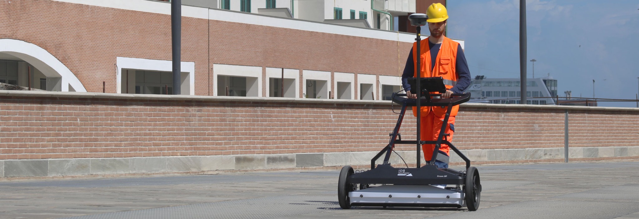
Multisensor Data AcquisitionGPR, Electromagnetic Detection and Geophysical Data

IDS GeoRadar operator using a GPR system during a field survey
From survey to network reconstruction

06 / OUTPUT

2D, 3D, CAD and GIS Deliverables

01

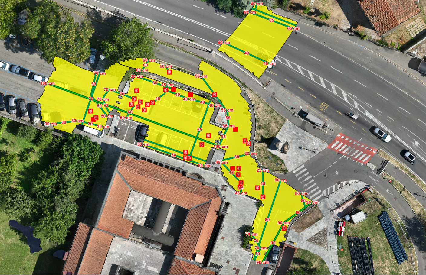
2D survey

Utilities and depths in plan view.

Georeferenced 2D underground utility map
2D survey
02

3D survey

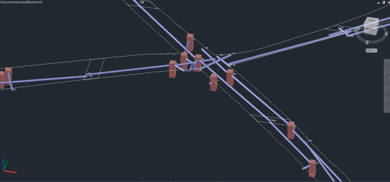
Geometry and spatial relationships.

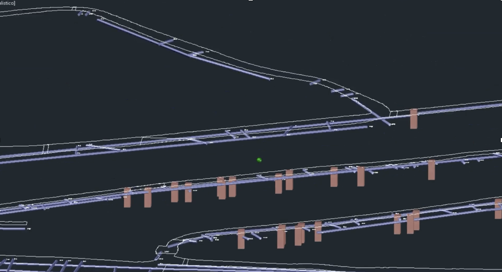
3D reconstruction of buried utility networks showing depth and geometry
3D survey
03

GIS

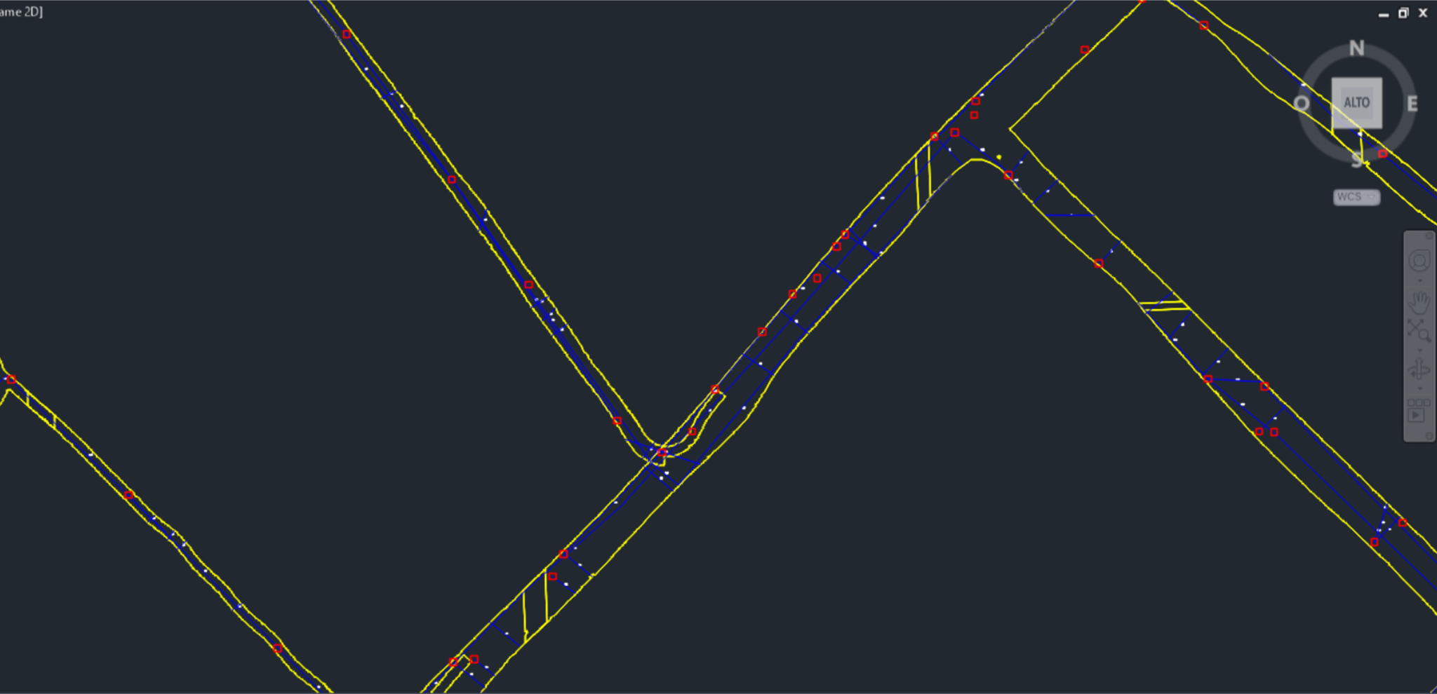
Georeferenced data for client systems.

GIS output from an underground utility survey
GIS
04

Materials

Materials differentiated where supported by the data.

Classification of metallic and non-metallic buried utilitiesMETALLICNON-METALLIC
Materials

07 / BEFORE EXCAVATION

From Survey Data to Subsurface Intelligence

  1. 01Fewer utility conflicts
  2. 02Better planning
  3. 03Greater operational continuity
  4. 04Outputs for integration into technical workflows

Industries we serve

The same subsurface interpretation capability, applied across infrastructure environments.

09 / USE CASES

Infrastructure, Utilities and EPC Applications

Three real underground utility mapping projects.

Visualizzazione DeepGeo.AI della mappatura dei sottoservizi nel progetto Italgas

SaaS / underground utilities

Underground utility mapping in Cisterna di Latina

−65%Processing time compared with traditional methods

Client-uploaded data processed in the cloud for underground utility mapping.

Italgas S.p.A.

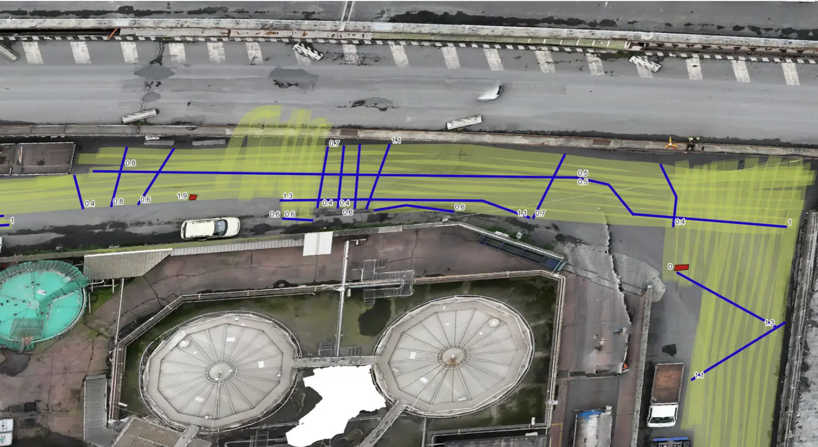
Mappatura del sottosuolo per una nuova linea di rete a Piacenza

Utilities / design

New utility line in Piacenza

GIS + DWGDesign support

Subsurface characterisation and GIS outputs supporting design.

Iren

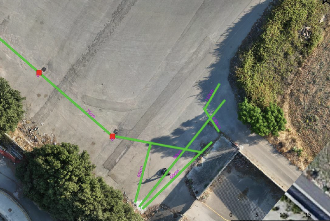
Georeferenced utility map for the Escolight RFI project

Rail / underground utilities

Underground utility mapping for Escolight / RFI

GIS outputGeoreferenced utility routes

Non-invasive surveys and GIS outputs locate undocumented buried infrastructure.

Escolight Srl / RFI

10 / THE XPLORA DIFFERENCE

A different approach to subsurface mapping.

One workflow connects acquisition, interpretation and technical outputs.

AspectTraditional approachXplora + DeepGeo.AI
01 /Field acquisitionMore field visits and longer operating time.A coordinated workflow reduces field visits and operating time.
02 /InterpretationManual interpretation takes longer and depends on the operator.AI standardises extraction and classification of the data.
03 /Georeferencing and GISGIS integration requires additional processing and reconciliation.Georeferenced data ready for GIS workflows.
04 /OutputTechnical delivery requires further manual work.2D, 3D and GIS outputs ready for the project.

Chosen by utilities and network operators.

11 / LET’S DISCUSS YOUR PROJECT

Have a site to map?

Send the site boundary and planned work; Xplora will assess the right approach.

Talk to the team

FULL-SERVICE / XPLORA

Request a quote

Tell us about the work and send us the project area. Our team will review your requirements and contact you with a tailored proposal.

* Required fields

Type of service *

You can select more than one service.