EPC & Infrastructure
Underground utility mapping for Escolight / RFI.
Non-invasive surveys and GIS deliverables to locate undocumented buried infrastructure.
GIS outputGeoreferenced utility routes
Explore the case study  Request a quote
Utilities & Grid / EPC & Infrastructure
Tecne Autostrade
THE CONTEXT
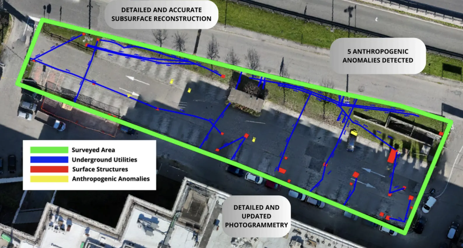
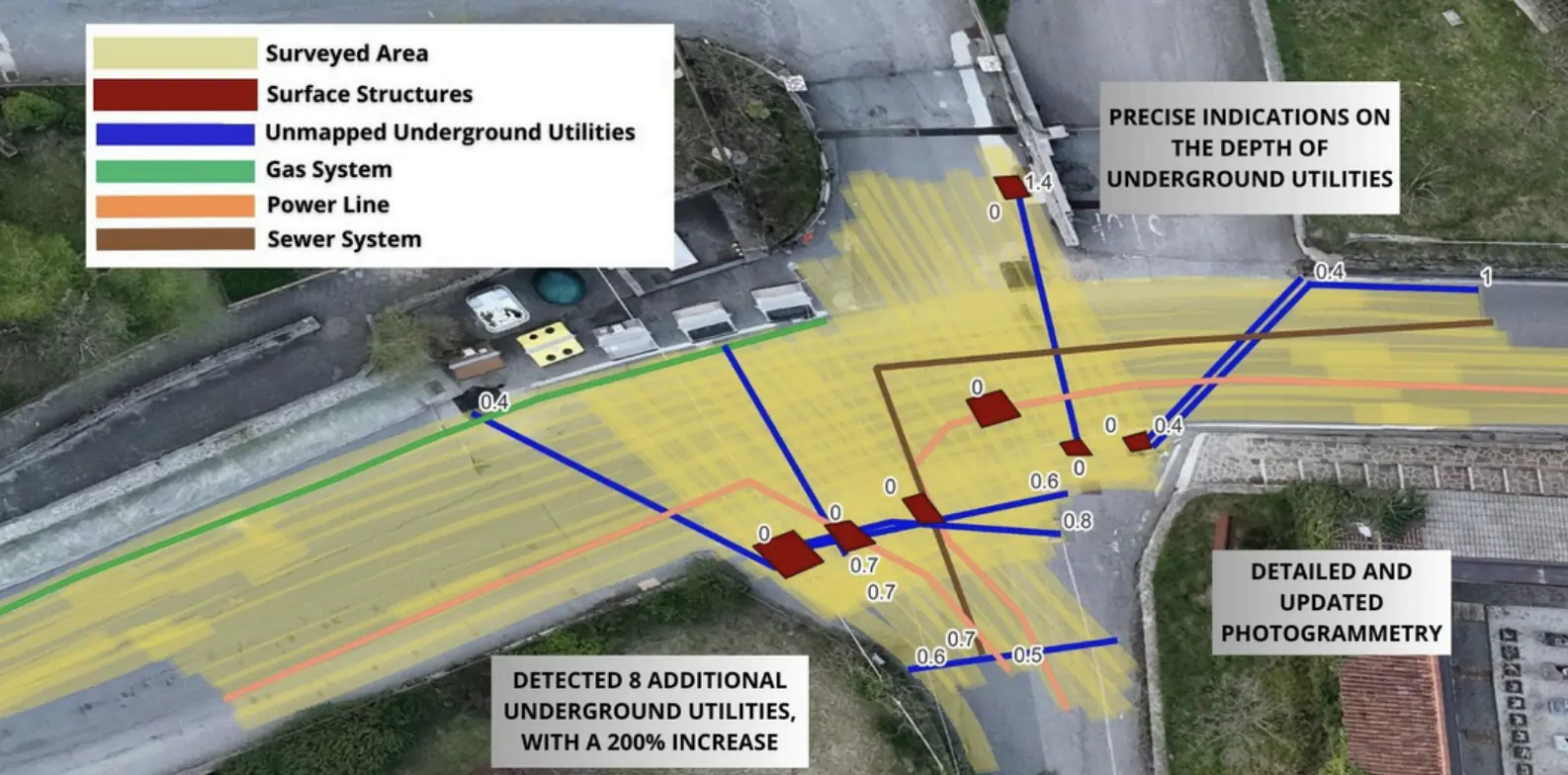
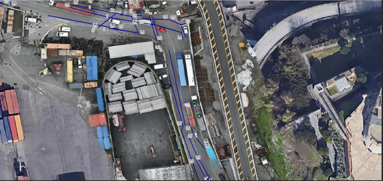
Mapping of underground linear utilities (fiber optic cables, electrical lines, aqueducts, corrugated pipes, etc.) and non-linear underground utilities (tanks and other artificial objects) up to 3 meters below ground level.
THE CHALLENGE
Xplora drastically reduced the occurrence of undetected pipes, preventing damage and breakages during excavation.This required a combination of advanced technologies, updated photogrammetric data, and comprehensive surveys to ensure accurate mapping in a densely anthropized environment.
OUTPUTS
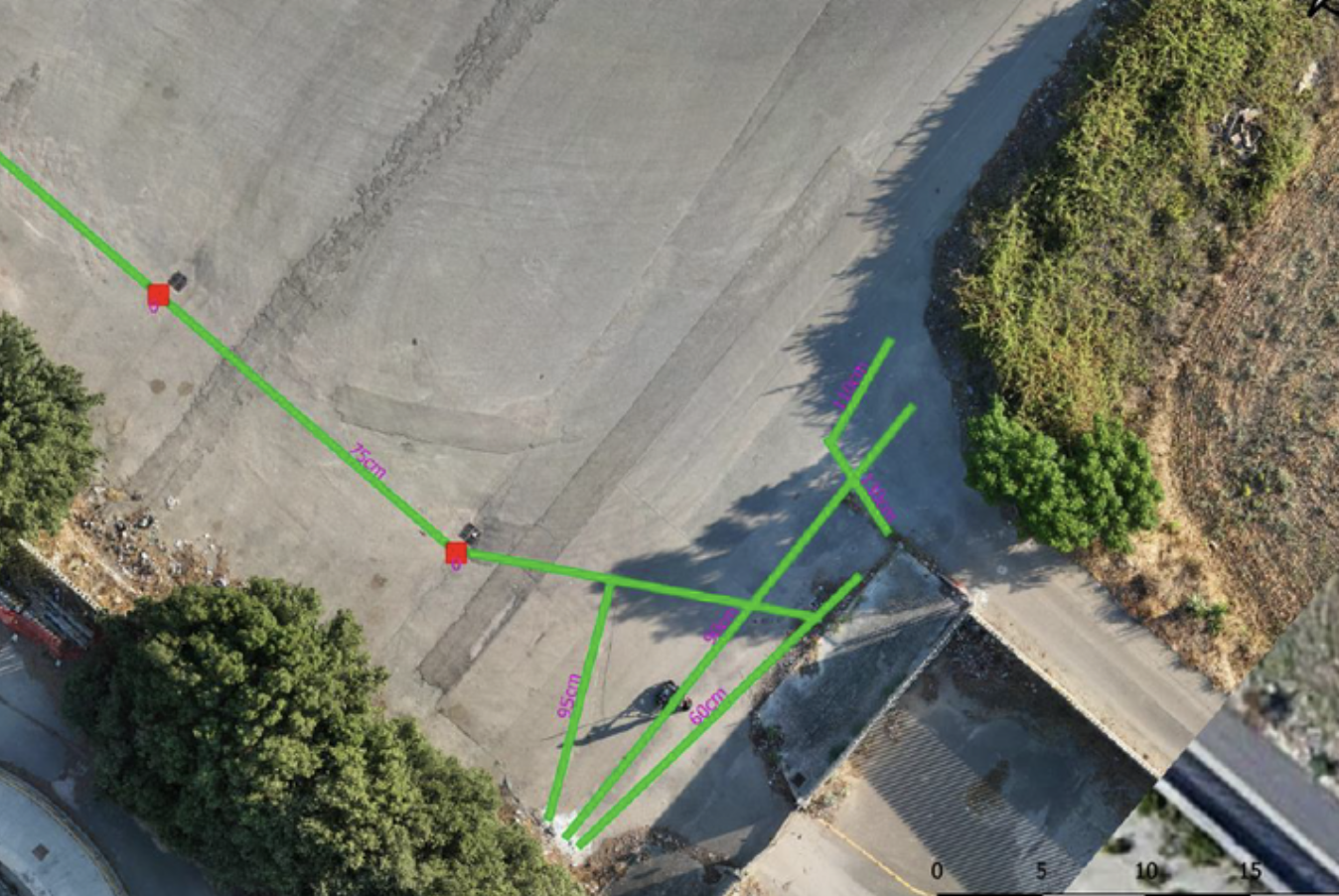
GIS project with updated photogrammetry and layout of underground utilities and buried structures, including characterization, type, and depth indication.
DWG file for CAD processing.
EXPLORE MORE
EPC & Infrastructure
Non-invasive surveys and GIS deliverables to locate undocumented buried infrastructure.
Utilities & Grid
Underground utility mapping supported the layout of high-power charging cables at the Vulcano Shopping Center in Nola.
Utilities & Grid
Three-dimensional utility mapping supported the installation of new services while limiting disruption to traffic.
YOUR NEXT PROJECT
Let’s discuss your site, the risk and the outputs you need.
Request a quote